Tuesday 26 October 2010

How to use Vector works dwg files in a Revit model

You may not have problems with these files but if you do it is likely to be caused by shared cells (Microstation term) or cells (also Microstation term) and also if the model is a long way from the origin this also causes problems. The problems occur with the file appearing to be over the 20 mile limit. This because the cells or shared cells have an origin that is more than 20 miles from the elements. Do the following

1. Open the dwg in Microstation
2. Save the file as a dgn
3. Move the global origin to close the the drawing or in the middle of the drawing (go= )
4. Check that the global origin has moved by placing a line from xy=0
5. Save settings to save the position of the global origin
6. Select all the shared cells by using the Select By Attributes tool
7. Drop the shared cells to geometry only. Make sure this has happened
8. Save the file back as a DWG and then reload into your Revit model

Revit printing to A3 Black and White printer Canon 5055N


The default settings do not allow for a thicker border on the right hand side of the page. To manage this, it is possible to move the page slightly to the left so that all elements are visible. Here is the print dialogue box showing the settings used.


Wednesday 20 October 2010

Microstation Luxology Engine failure


When we moved to service release 2 of Microstation V8i Luxology had a problem. Half way through rendering anything (of any size) the process would stop with the message the the luxology engine had failed. If we tried the same rendering with a completely default install with no network workspace there was no problem. Also some users did not experience the problem. These were users that had already used Luxology with other earlier versions of v8i. The problem was that the luxology history variable had not been set. This can be set manually from the luxology settings (at the bottom). If it is set manually there is no problem. The other way to set it, is to use the MS_LUXOLOGY_HISTORY variable in your standard config. We have set ours to $(400-fcbdata) which is mapped to the project data folder. This variable sets where a thumbnail of the previous render is stored.

Tuesday 19 October 2010

Aquiring Coodinates in Revit - Its easy when you know how


Revit has a strange way of using a coordinate system. Traditional CAD (AutoCAD and Microstation) allows the use of Auxillary coordinate systems so you can have a number of different oring points, North angles and relative positions.

Revit is different. With Revit, models should always be drawn at the centre of the file near the world 0,0 point. This can be found by viewing the default "Site" view in a Revit file. The site view has the survey 0,0 and the world 0,0 turned on so they can be viewed.

To add a true coodinate system on to the Revit model, first link a DWG (or Revit file) that contains a survey point or grid. if you are starting to work with a project that already has a grid in the correct place, use the grid file as this contains the key monument points for the whole project.

When you link the DWG survey file or grid file, position it center to center so that the grid appears near the survey and world 0,0 points. It is likey that the grid file will appear at an agle too.

Now the important bit. Make sure that you only move the linked CAD file and not the model file itself. With other CAD systems you usually work the other way round and you never move the attached grid file.

Rotate the linked file to the correct angle so that the grid runs left to right and up to down correctly. Now position the grid in exactly the right position by moving the linked file. Once the linked file is in the correct position and the correct angle you are now ready to aquire the coordinates.

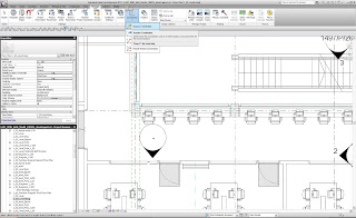
click on Manage (from within the Revit menus) then Coordinates then Aquire Coordinates. Now click on the linked CAD file. This will add the coordinate system to the Revit file and you will now be able to link other revit files and CAD files using shared coordinates (instead of center to center etc) so that the files appear in exactly the same location.